What is GPS Map Camera?
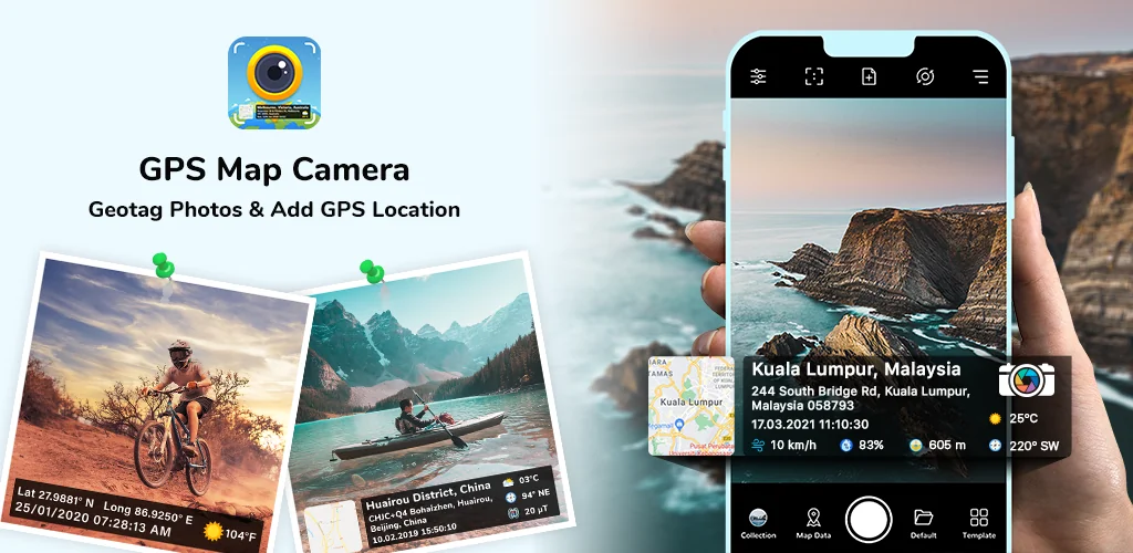
Most camera apps capture a moment. But they often leave you guessing where or when that memory truly happened, just a blank spot on the map. GPS Map Camera flips that script. It transforms your pictures into rich, data-packed memories, giving every shot a story.
I was genuinely curious. Could it really embed so much detail without fuss? Turns out, yes. Just open the app, snap your shot, and watch the magic happen. It auto-stamps everything. Imagine sending a photo of your new home’s progress with precise coordinates and construction date. Or sharing that amazing dinner spot with the exact address and current weather. This isn’t just basic geotagging. GPS Map Camera pulls in latitude, longitude, altitude, and even the magnetic field. You get the full story. Want to add your own flair? You can customize your photo location stamp with your logo or notes.
This app makes documenting travel adventures or remembering that perfect restaurant simple. It goes deep, far beyond what generic photo apps offer. You can even access advanced camera controls like grid lines and scene filters directly within the app.
What stands out:
- Customizable Templates → Choose simple auto-stamps or advanced layouts for every detail.
- Detailed Geotagging → Automatically embeds latitude, longitude, address, and altitude onto your photos.
- Environmental Data → Adds real-time weather, magnetic field, and wind speed to your images.
- Personalized Branding → Include your own logo, notes, and hashtags for a unique photo stamp.
Tired of photos that tell only half the story? Give your memories the context they deserve. Download GPS Map Camera and start capturing every detail today!



Share your experience with other users.